




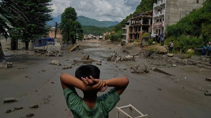
Nepal Flood kills at least 95 people as hundreds remain missing after a devastating Bhotekoshi River disaster. Read the latest details on casualties, damage, forecasting and rescue operations.
Qalam Times News Network
KATHMANDU, August 26, 2026
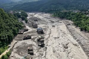
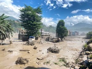
A devastating flood in Nepal’s Rasuwa and Nuwakot districts has left at least 95 people dead, while hundreds of others remain missing after a sudden surge of water swept through communities, roads and infrastructure along the Bhotekoshi River on Wednesday morning.
The flood struck at around 8:40 am and caused extensive destruction in areas near the Nepal-China border. According to the government, 19 motorable bridges and around 40 kilometres of paved roads have been damaged. Rescue teams are continuing search operations, while authorities warn that the number of casualties could increase as more affected areas are reached.
Among those reported missing are 44 Nepal Army personnel, 28 Nepal Police personnel and 13 members of the Armed Police Force. The authorities also reported that 391 foreign tourists and 93 Nepali tourists in the affected areas had lost contact with their families or officials.
At least 60 workers employed at different hydropower projects are also missing. Personnel working at the Rasuwagadhi Customs Office and Immigration Office have likewise been reported out of contact.
The identities of the 95 recovered bodies had not been established by 7 pm, according to Nepal’s Prime Minister’s Office and Council of Ministers. Search and rescue operations remain underway in the affected locations.
Why Nepal’s Extreme Terrain Makes Flood Forecasting Difficult
The latest disaster has renewed concerns about Nepal’s ability to predict sudden weather-related emergencies in one of the world’s most geologically fragile mountain regions. Initial reports indicate that a moderate earthquake may have triggered a landslide or contributed to a glacial collapse, potentially blocking a river and then releasing a destructive volume of water downstream.
Nepal’s mountainous geography makes such disasters particularly difficult to forecast. The country contains steep ridges, narrow river valleys, rain-shadow areas and highly varied terrain. Weather conditions can therefore change dramatically over relatively short distances.
The disaster also highlights the importance of stronger communication between Nepal and China. Early warnings about events such as glacial lake outbursts, landslides or sudden changes in river conditions need to reach communities downstream quickly enough for authorities to take preventive action.
Nepal had earlier been warned to prepare for a weak and delayed monsoon. Forecasts had suggested below-normal rainfall and above-normal temperatures, partly because of changing conditions in the Pacific. However, the eventual rainfall pattern has demonstrated why national averages alone cannot provide an accurate picture of local flood risk.
Nepal’s Department of Hydrology and Meteorology generally considers 90 to 110 per cent of long-term monsoon rainfall to be within the normal range. Yet a country stretching from the Gangetic plains to the high Himalayas cannot be adequately represented by a single seasonal average.
One area may receive relatively little rain while another experiences extremely intense rainfall within a few hours. Such short-duration, high-intensity events can trigger landslides, destroy roads and overwhelm rivers even when the overall seasonal rainfall remains statistically normal.
Recent flooding in areas around Phulchoki, Panauti and Dhulikhel repeatedly sent water towards the BP Highway. Temporary road diversions built after the September 2024 floods were washed away, while permanent reconstruction has required authorities to raise sections of the road substantially above the riverbed.
The latest Bhotekoshi disaster also sent floodwater downstream through the Trisuli River towards Mugling and Narayangad. Authorities closed the Prithvi Highway, while bridges further downstream were reportedly destroyed.
Nepal has already experienced repeated disruptions caused by monsoon floods and landslides this year. During one week in July, nine highways were blocked simultaneously. Flooding and landslides have also damaged roads and hydropower infrastructure in several districts, leaving some routes inaccessible for extended periods.
By mid-August, Nepal Police had reported at least 85 deaths linked to monsoon-related disasters since April across 19 districts. The latest disaster is expected to push the overall toll considerably higher.
Modern forecasting has made significant progress. The probability of correctly predicting whether rainfall will occur on a particular day is now estimated at around 90 per cent, helped by satellite observations, numerical weather models and regional cooperation.
The major weakness is at the local level. Current forecasting systems often cannot provide a sufficiently precise prediction for an individual municipality, ward or farming community, particularly in Nepal’s highly complex terrain.
Global weather models generally work with grid cells measuring roughly 10 to 25 kilometres. Nepal’s mountains, however, can change weather conditions within distances of only a few kilometres or even hundreds of metres.
A windward mountain slope and a valley on the opposite side may therefore experience substantially different rainfall from the same weather system. This creates serious challenges for communities that need warnings about flash floods, landslides and river surges.
The disaster has also exposed weaknesses in the way infrastructure is planned. Water-supply projects, hydropower facilities, irrigation schemes and roads have often been designed using weather or river data collected far from the actual project location.
In some cases, project planners rely on information from an airport or district headquarters tens of kilometres away, even though the surrounding terrain may be completely different. A hydropower project in Myagdi, for example, may depend on rainfall information from Pokhara, while a rural water project in Okhaldhunga may use river-flow data recorded much farther downstream.
When infrastructure subsequently fails during an extreme event, climate change is often blamed. While climate change can certainly increase risks, inadequate local measurements and planning based on unsuitable data can also leave infrastructure unnecessarily vulnerable.
Automatic weather stations could provide an important part of the solution. These systems continuously measure rainfall, temperature, humidity and wind. Modern solar-powered equipment is considerably more affordable than it once was, allowing municipalities, schools and government offices to install local monitoring stations.
Some municipalities have already begun using such systems. A wider network of stations could provide detailed information about individual watersheds and help authorities identify dangerous changes much earlier.
Traditional knowledge from farming communities could also complement scientific measurements. Farmers who have lived for generations in the same valleys often know which slopes receive rain first, how particular springs respond to heavy rainfall and which cloud formations may signal severe weather.
Such local knowledge cannot replace scientific instruments, but it can provide valuable information that large-scale forecasting models may miss.
A stronger municipal warning system could therefore combine several sources: automatic weather stations for real-time measurements, satellite information for wider coverage, official forecasts from Nepal’s Department of Hydrology and Meteorology, and carefully documented observations from local communities.
The central lesson from the latest flood disaster is that Nepal’s challenge is not simply whether its seasonal forecast was correct. The bigger issue is whether forecasts are detailed enough to support decisions at the community level.
Farmers need to know when heavy rain is likely to arrive in their particular watershed, how intense it could be and whether the ground is already saturated. Municipal authorities need to know whether a dangerous rise in river levels could occur within the next 24 to 48 hours and which settlements may need to evacuate.
Nepal may never be able to predict every individual rainfall event. But with better local monitoring, improved cross-border information sharing and stronger early-warning networks, authorities can significantly improve their ability to identify where dangerous water is accumulating and where communities are most at risk.
The latest tragedy is therefore not only a reminder of the destructive power of Himalayan weather. It is also a warning that disaster preparedness must be built around local, real-time information rather than relying primarily on broad national averages.




Nepal Flood Loot: Cash-Filled Bank Safe Swept Away By Floodwaters, 29 Held - Qalam Times